Gas Mapping LiDAR® in Europe
Built for Europe's toughest infrastructure. Ready for its toughest deadline.
Article 12's site-level reporting requirements arrive February 2027 — and operators are already building the monitoring programs they'll need to be ready. With Bridger's proven aerial laser technology, you can quickly identify your biggest emissions sources without putting crews in remote or hazardous locations.
Request a Demo
~2m
GPS-precise emitter location accuracy
12+
Peer-reviewed independent validation studies
30+
Patents protecting GML technology
Why European Operators Choose Bridger
Europe's energy landscape has specific demands — from offshore platforms to cross-border pipeline networks. Bridger's aerial approach is designed to meet them.
Protect your people first
Europe's offshore platforms, onshore production, and transmission assets often span remote, exposed, or hard-to-access terrain — from the North Sea to inland pipeline corridors. Bridger's aerial approach can help teams identify and prioritize issues before anyone is sent into the field — so every deployment is targeted, not exploratory. Bridger flies fixed-wing aircraft or UAV depending on the asset, so the platform matches the terrain, not the other way around.
Coverage at European scale, with rapid prioritization
Hundreds of sites or hundreds of kilometers of pipeline covered in a single day — across borders and jurisdictions. No ground infrastructure to install. No hardware on each site. Every scan rapidly screens and prioritizes emissions by rate, so field teams know exactly where to go. Share your GIS data with Bridger's team, and we handle the rest — from flight logistics to full data delivery.
Ready for Article 12 — before the deadline hits
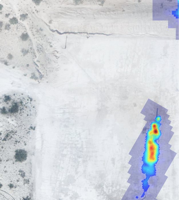
Article 12's site-level measurement and reporting requirements take effect February 2027 — and building a defensible program takes time. Every Bridger scan delivers quantified, site-level methane data, gas plume imagery, and equipment-level GPS coordinates that scale across your full network — validated by more than a dozen independent peer-reviewed studies.
The Technology
How Gas Mapping LiDAR® works
Laser-based aerial scanning that detects, locates, and quantifies methane — remotely, precisely, and at scale.

You share your asset GIS data
You share your asset GIS data Simply provide the GIS coordinates of the assets you’d like scanned. Bridger designs tailored flight plans to ensure full coverage across your sites or pipeline corridors.

Aerial laser sensors scan your assets
GML sensors mounted on small aircraft emit laser light that is absorbed by methane molecules. The system detects, locates, and quantifies emissions continuously as the aircraft flies — no ground crew required.

24-hour safety alert for large emitters
Any emission above your pre-set threshold triggers a same-day safety notification — so your team can respond to the highest-priority issues immediately.

Full Data Report within 2-3 Days
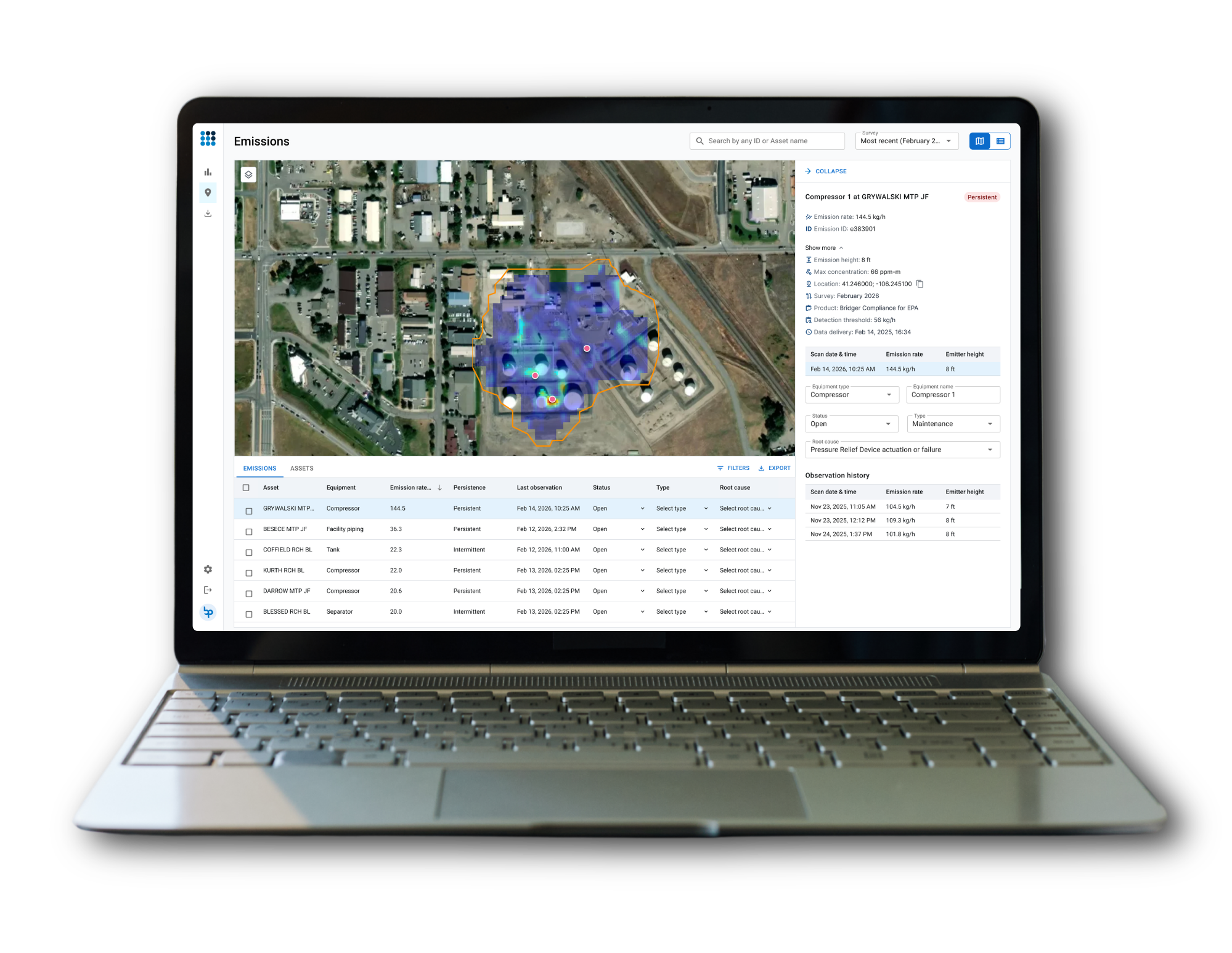
mission rates, equipment-level GPS locations, plume imagery, and aerial photography — delivered via Bridger Command in any format your team needs. Your field crews know exactly where to go.
Concentration-based sensitivity (ppm)
configurable aligned to Article 14's Type 1 and Type 2 survey thresholds
-
~2m Emitter location precision
-
24hr Safety alert turnaround
Wind & measurement accuracy: GML quantification is a direct function of wind speed. Independent studies show quantification uncertainty of ±31–68% near the sensitivity limit — a well-characterized range that supports transparent, defensible reporting.
Deployment Methods
Fixed Wing
Best suited to transmission networks and other long, linear infrastructure — stable routes flown at scale, covering hundreds of kilometers in a day.
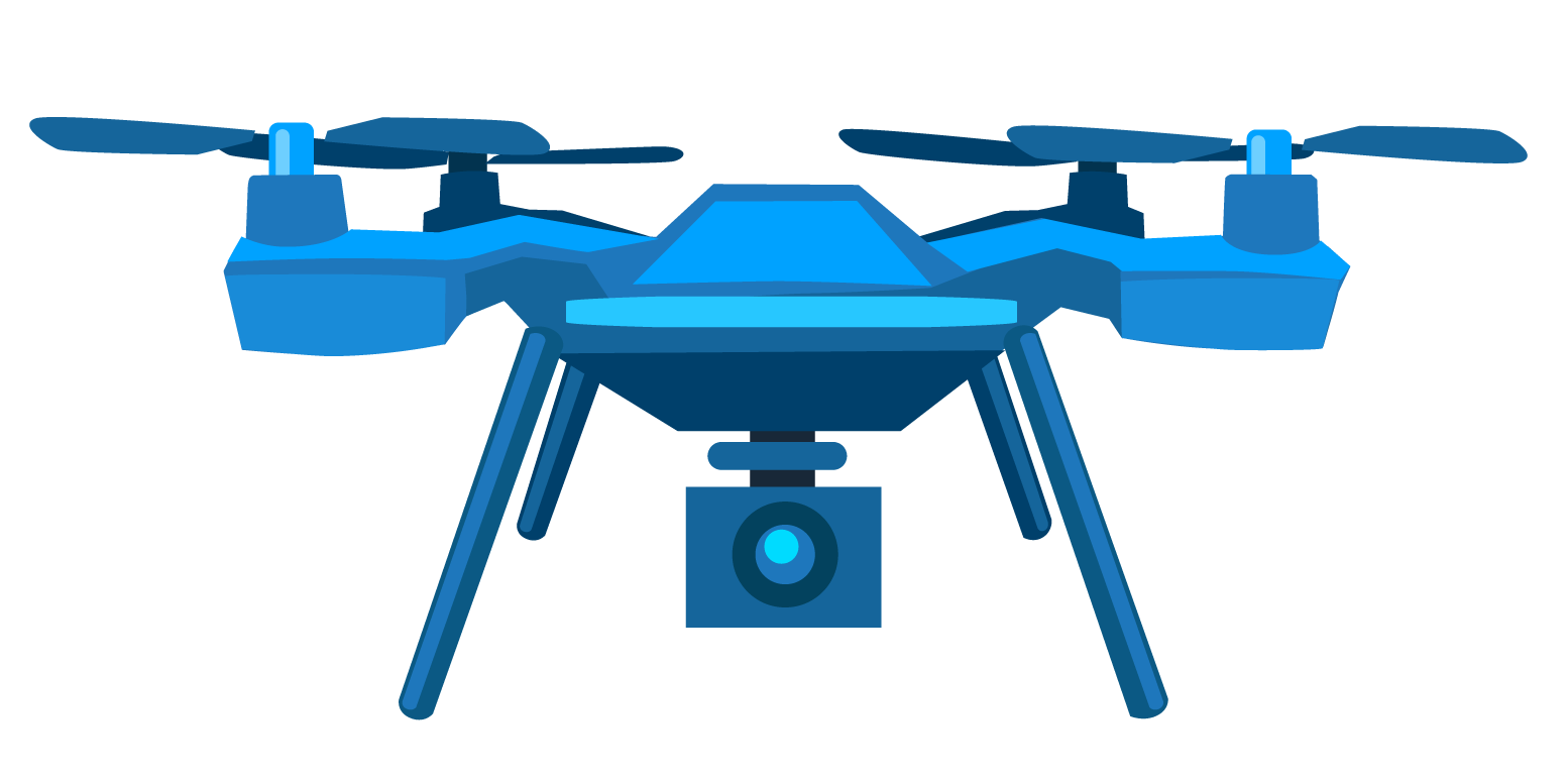
UAV (drone)
Best suited to offshore platforms and other sites that need closer, vertical-profile inspection.
Both platforms carry the same GML sensor and deliver the same data output.
What Bridger Can Help You Do
Reduce unnecessary field exposure
Aerial detection rapidly screens and prioritizes emissions before you send crews to remote or offshore sites for routine inspection. When your team does go to the field, they arrive knowing exactly what they're looking for — and where. Fewer exploratory trips. Safer operations.
Turn detection into value — however you're paid
If you own the gas — production, onshore, offshore, or LNG import — every leak found is recovered gas and recovered revenue, not lost product. If you're a transmission operator, Bridger supports the OPEX efficiency and regulated performance incentives tied to running your network well, plus the system integrity, preventive maintenance, and environmental safety benefits that come from scanning more frequently.
Find what ground-based methods miss
Bridger's technology can help identify emissions that intermittent manual surveys may not catch — particularly across the scale and spread of European transmission and production networks. Equipment-level source localization means your repair teams address root causes, not symptoms - the foundation of a defensible LDAR program.
Get ahead of Europe's compliance deadlines
GML data may support measurement-based reporting aligned to OGMP 2.0 Level 4 and Level 5, and can help build the audit trail behind EU Methane Regulation Article 14 (LDAR) and Article 12's site-level measurement and reporting requirements — which take effect February 2027. For operators scaling up broader MRV and LDAR programs now, Bridger's site-level methane quantification is built to grow with you rather than requiring a rebuild closer to the deadline.
Trusted by leading global energy operators, built to deliver in Europe
Bridger's technology is already proven with major international operators — and our work across Europe's offshore, onshore, and transmission infrastructure is underway.
Bridger's European operations team coordinates flight planning, GIS data handling, and cross-border logistics in-region — so programs move at the pace European compliance timelines demand, not the pace of a program run remotely from overseas.
How ExxonMobil Gained Basin-Wide Methane Visibility With Aerial LiDAR Technology
Bridger's aerial methane detection technology helped ExxonMobil efficiently monitor a large production basin by identifying, quantifying, and locating emissions. Detailed measurement data enabled faster field response and more informed maintenance decisions.
Aligning Source- and Site-Level Measurement for Confident Decisions
By combining source- and site-level methane measurements within a single coordinated program, Bridger provided the operator with both clear source attribution and facility-scale emissions visibility within a narrow operational timeframe.
Bridger's European work spans offshore platforms, onshore production, LNG import terminals, and the transmission networks (TSOs) connecting them.
Onshore
Offshore
LNG
Transmission (TSO)
Well Pads & Processing Facilities
Cover onshore production and storage sites efficiently, with tailored flight plans — by aircraft or UAV depending on site layout — built around your asset footprint.
North Sea platforms & subsea infrastructure
Surveyed by UAV, well suited to the vertical profile of offshore platforms. Detect, locate, and prioritize emissions by rate — so maintenance effort goes where it matters most, without putting crews on a platform unnecessarily.
Facilities & Export Terminals
LNG buyers and investors globally are placing growing importance on methane accountability. Bridger can help LNG operators build the measurement-based data programs that support credible reporting.
Cross-border pipeline networks
Flown by fixed-wing aircraft, scanning hundreds of kilometres per day. GML's aerial approach is purpose-built for Europe's long-distance transmission networks — coverage that isn't practical with ground-based methods — and supports the network-modernization and hydrogen-readiness planning many TSOs are undertaking now.
Frequently Asked Questions
-
How does Gas Mapping LiDAR actually measure methane?
GML sensors emit laser light at a wavelength that methane molecules absorb. As the aircraft flies over assets, the system measures how much light is absorbed; deriving a path-integrated concentration reading. This is combined with emission modeling to estimate a leak rate and GPS-locate the source.
-
Does wind affect accuracy?Wind speed is a factor in quantification accuracy — and Bridger is transparent about this. Independent studies show uncertainty of ±31–68% near the detection limit, with performance improving as emission size increases above the sensitivity threshold. On-site wind data can further reduce uncertainty.
-
What detection sensitivity is used for European operations?Bridger calibrates each program to your assets and goals rather than publishing a single fixed sensitivity figure. Our team works with you to define detection and reporting thresholds appropriate to your sites and can walk your team through how GML performance supports your EU Methane Regulation and OGMP 2.0 objectives.
-
When do Article 12 site-level reporting requirements take effect?February 2027. Operators are already building the measurement programs they'll need well ahead of that date — Bridger can help you start now with scalable, site-level methane quantification, rather than scrambling as the deadline approaches.
-
How long does a scan program take to set up?After an initial kickoff meeting to review your goals and GIS data, Bridger handles all flight planning and logistics — including cross-border coordination where needed. First safety alerts are delivered within 24 hours of a scan, with full reports in 2-3 business days.
-
Can the technology cover cross-border and offshore European assets?Yes — remote and offshore coverage is one of GML's core strengths. The aerial approach covers hundreds of sites or hundreds of kilometres of pipeline per day, with no requirement for personnel or hardware in the field during the scan.
-
Does Bridger use aircraft or UAV for scans?Both — Bridger deploys whichever platform best fits the asset. Fixed-wing aircraft are typically used for transmission networks and other large, linear infrastructure that can be flown in stable, continuous routes. UAVs (drones) are typically used for offshore platforms and other sites that need closer, vertical-profile inspection. Both platforms carry the same Gas Mapping LiDAR® sensor and produce the same data output — quantified emission rates, plume imagery, and GPS-located sources.
-
Does Bridger support EU Methane Regulation and OGMP 2.0 reporting?GML data is designed to support measurement-based reporting aligned to OGMP 2.0 Level 4/5, and can help build the audit trail behind EU Methane Regulation Article 12 (MRV) and Article 14 (LDAR) requirements. Bridger's team can walk your compliance stakeholders through exactly how the data maps to your reporting obligations.
-
What data do we actually receive?Each scan delivers emission rates, maximum path-integrated concentration, methane plume imagery, emitter GPS coordinates, intermittent/persistent designation, and aerial photography — all delivered in GIS, Excel, and PDF formats via our web platform, Bridger Command.

Ready to see what Bridger can do for your European operations?
Article 12's site-level reporting requirements take effect February 2027. Talk to Bridger's team now about what a monitoring program built well ahead of that deadline could look like.
Contact Us
Reach out Today!
- Location: Switzerland
- Contact: Bruno Gama Regional Director - Europe
- Phone Number: +41 78 867 3034
- Email: bruno.gama@bridgerphotonics.com