Learn
What is LiDAR?
Light detection and ranging, or LiDAR, uses laser technology to measure either distance or the presence of a gas. Bridger Photonics makes use of continuous-wave LiDAR in our innovative technologies.
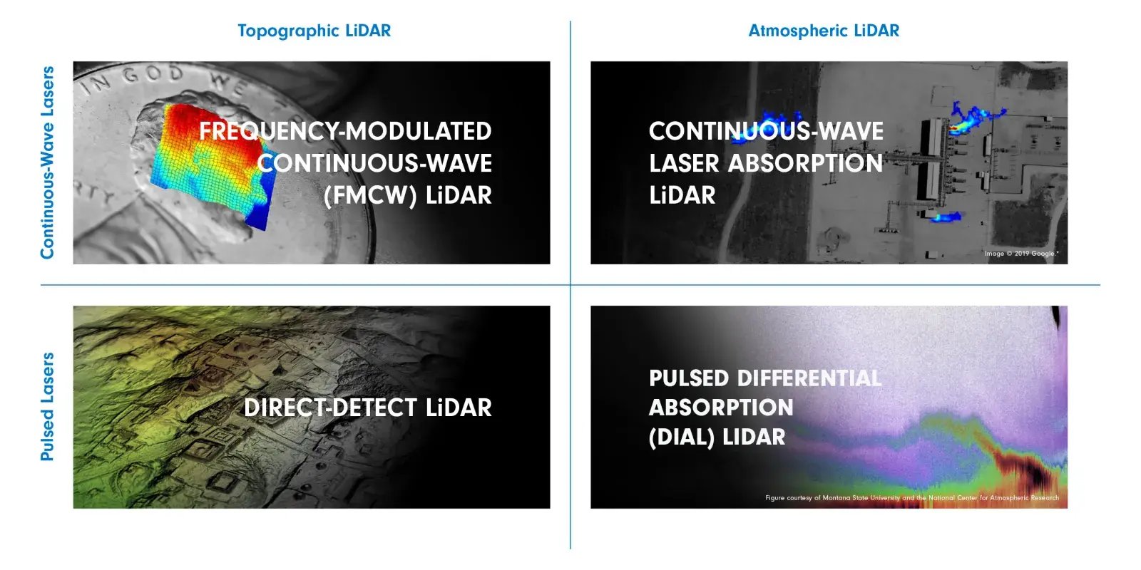
TOPOGRAPHIC LiDAR WITH CONTINUOUS-WAVE LASERS
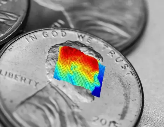
Frequency-Modulated Continuous-Wave (FMCW) LiDAR
FMCW LiDAR uses the frequency (i.e. color) of the laser light to determine distance. This method enables the simultaneous measurement of distance and velocity, generating precise location data. LiDAR technology plays a crucial role in enabling these precise distance and velocity measurements.
How it works:
- Transmit a continuous-wave laser to a portion of the object, where the laser’s frequency is intentionally changed in time.
- Measure the time it takes a certain laser frequency to travel to and return from that part of the object using interferometric techniques.
- Calculate the distance to that part of the object using the constant speed of light.
- Scan the laser beam over the object to determine the distance to all parts of the object and to create 3D imagery.
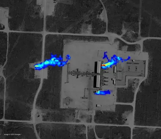
ATMOSPHERIC LiDAR WITH CONTINUOUS-WAVE LASERS
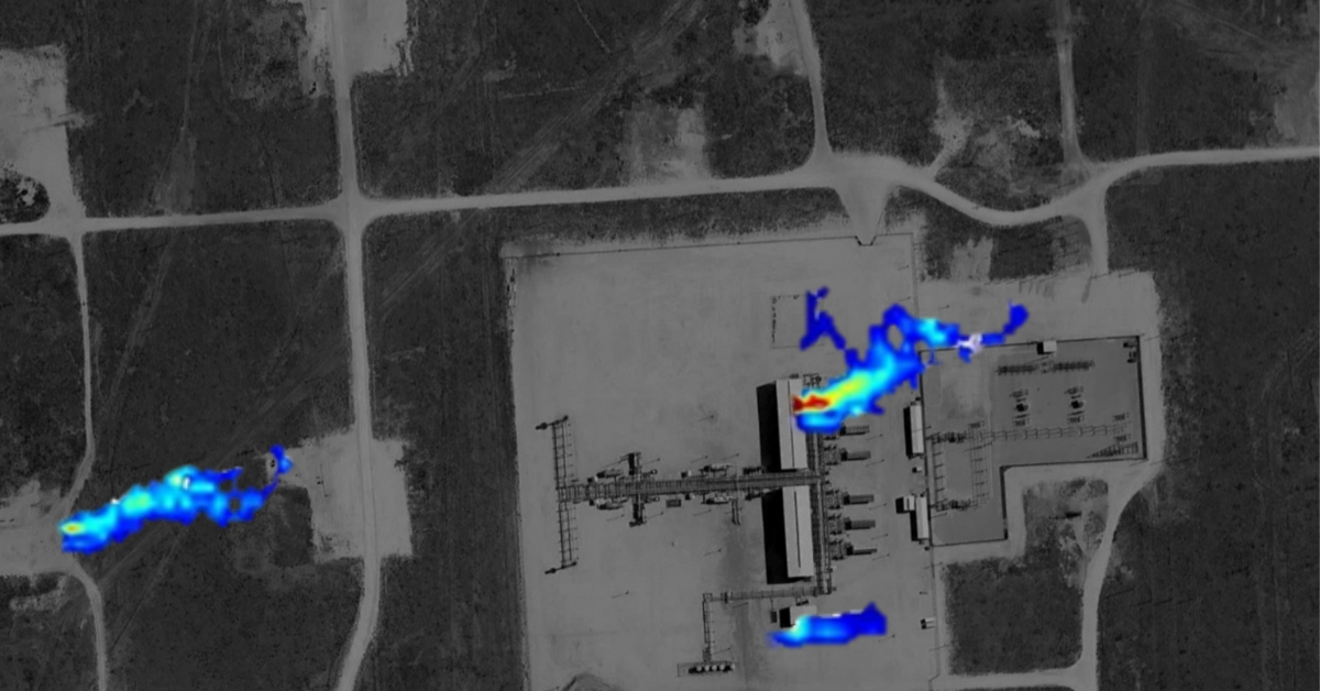
Continuous-Wave Laser Absorption LiDAR
A continuous-wave laser can be changed or modulated to achieve the same effect as differential absorption. This laser absorption spectroscopy technique is known in various forms as wavelength modulation spectroscopy (WMS), frequency modulation spectroscopy (FMS), or tunable diode laser spectroscopy (TDLAS). Bridger mounts the LiDAR systems on aircraft, so the ground serves as a scattering point of laser light back to the LiDAR system. Airborne LiDAR systems are particularly effective for atmospheric measurements, maintaining accuracy over long distances and providing detailed topographic and elevation models.
How it works:
- Transmit a continuous-wave laser through the gas to the ground with a laser frequency that is known to be absorbed by the gas.
- Modulate the laser’s frequency in time.
- Determine the concentration of the gas in the beam path by measuring the amount of modulated laser light returning from the ground.
- Scan the laser beam to determine gas concentration for all areas and to create gas plume imagery.
- LiDAR instruments used in this process shoot laser pulses to create detailed 3D models and point clouds, essential for accurate gas concentration measurements.
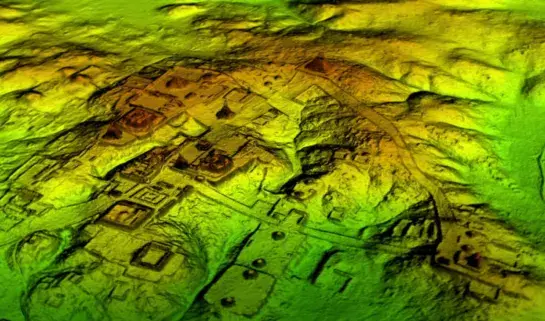
TOPOGRAPHIC LiDAR WITH PULSED LASERS
Direct-Detect LiDAR
Using the fact that each gas absorbs a specific frequency of laser light, pulsed DIAL can determine the concentration of a gas by comparing the returning light from a laser pulse that is absorbed by a gas to a laser pulse that is not absorbed by the gas. The integration of the global positioning system enhances the accuracy of LiDAR measurements by precisely determining the position and orientation of the instruments, especially on mobile platforms like airplanes and satellites.
How it works:
- Transmit a laser pulse to a portion of the object.
- Measure the time it takes for the laser pulse to travel to and return from that part of the object.
- Calculate the distance to that part of the object using the constant speed of light.
- Scan the laser pulses over the object to determine the distance to all parts of the object and to create 3D imagery.
ATMOSPHERIC LiDAR WITH PULSED LASERS
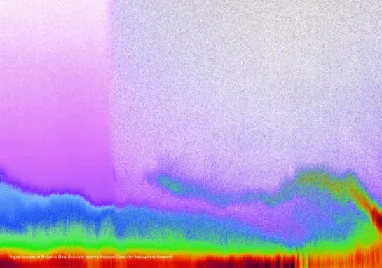
Pulsed Differential Absorption LiDAR (DIAL)
Using the fact that each gas absorbs a specific frequency of laser light, pulsed DIAL can determine the concentration of a gas by comparing the returning light from a laser pulse that is absorbed by a gas to a laser pulse that is not absorbed by the gas.
How it works:
- Transmit a first laser pulse to the gas with a laser frequency that is known to be absorbed by the gas.
- Transmit a second laser pulse to the gas with a laser frequency that is known to not be absorbed by the gas.
- Determine the concentration of the gas in the beam path by comparing the amount of light returning from the two laser pulses.
- Scan the laser beam to determine gas concentration for all areas and to create imagery.